Click on any image for a larger view
Brian Ham and I had tried to organize a much more modest fly-away to Broken Hill but it had fallen through due to people’s work commitments and possibly lack of interest, when Stuart Trist suggested a much more ambitious fly-away, a trip to Lake Eyre. Lake Eyre, when it has water in it is virtually an inland sea; nearly 150 km long and 75 km wide, and incidentally with about the same salinity as sea water. Stuart even partially promised that the lake held water, and it turned out that he was partially right. The plan was to leave on Monday and fly to Broken Hill for an overnight stay, then on to Marree for two nights with the return flight on Thursday. I thought this was a pretty unambitious plan but as it turned out was not achieved. On Monday, our departure day, the weather was fairly clear but with very strong north westerly winds. When I did my flight plan I found that I didn’t have sufficient range to reach Wentworth, our intended first fuel stop. I would have to refuel at Swan Hill and again at Wentworth. I drove from home to Kyneton thinking “This isn’t going to work”, but when I reached Kyneton conditions didn’t seem too bad so I loaded the Sonex and started the engine; well I attempted to start the engine. Damn, a short spin and that was it; flat battery. No problem, I have a booster battery and an Anderson plug, but either the Anderson plug connection was faulty or the booster battery was faulty. I pulled the cowl and connected the booster directly to the battery and the motor started easily. All this caused a fair delay so I phoned Brian and found that he was already at Swan Hill, so I headed off, hoping to catch them.
Kyneton to Swan Hill – 119 NM
Above 3000 feet, the air smoothed out , but that wind was fierce. I had never done a trip where my ground speed was under 100 knots before but at times it was under 80 knots and I don’t think I saw higher than 90 knots. When I finally reached Swan Hill and attempted a landing, turbulence at ground level was severe. On my second landing attempt I just flew along the runway waiting for a small gap in the ups and downs and then plonked it down. As I taxied in I noticed four yellow Bristells from Soar Aviation, a Moorabbin flying school. It was four students doing a long navigation exercise to Coober Pedy, and we were to see them a few more times on this trip.
Fuel used: 31.05 litres at $2.28/litre
Tacho time: 1.66 hours
Av Speed: 71.69 knots (good grief)
Swan Hill to Wentworth – 112 NM
As I was refueling, the Soar Aviation guys wandered past and prepared to leave. I had just landed on Runway 33, which appeared to be close to directly into the wind, but they all did the long back-track and took off from Runway 08. Full marks for the take-off in a howling cross wind, but why? I took off from 33 immediately after the last of the Bristells and by the time I had reached 4500 feet he was already 5 miles behind me. One other Bristell was also broadcasting its position on OzRunways and he was 10 NM ahead. The wind at altitude was still strong and ground speed slow but I soon found myself sliding underneath another Bristell. If you think I would be so childish and shallow as to take smug delight in my homemade Sonex being able to out-perform an aircraft that costs 5 times as much to buy, then you are a good judge of my character. I phoned Brian and he was already at Wentworth and waiting for Stuart. The rest of the leg was just a matter of holding my course through the grey sky, trying to dodge some fairly light rain and mopping up water on the glare shield when I failed. I passed one more Bristell, the one that had originally been 10 NM ahead of me, as he prepared for a straight in approach to Runway 36 at Mildura; into the wind, who’d have thought it? Wentworth is only 13 NM beyond Mildura so I started my descent and was relieved to find that the wind was directly down Runway 35 and that Brian and Stuart were waiting for me.
Fuel used: 29 litres at $2.31/litre
Tacho time: 1.51 hours
Av Speed: 74.17 knots
We adjourned to the warmth of the club house for a cup of tea and considered the next leg to Broken Hill. It’s only 127 Nm, but it was already after 3PM, weather to the north looked threatening and Stuart was worried about reaching it by last light with that strong northerly so we tied the aircraft down on the only patch of grass at the airfield and called a taxi. Unfortunately, Wentworth no longer has a taxi service but a nice woman from the local information office happily drove to the airfield and gave us a lift to town. Thanks, Karen. Accommodation was at a premium because of a number of work gangs in town, but on our third try we found a couple of rooms in a motel and adjourned to a pub for drink and meal. I’d like to say that the meal was memorable but I don’t remember it.
Wentworth to Broken Hill – 127 NM
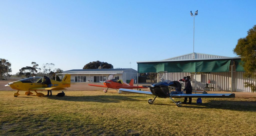
Stuart and I opted for a hot breakfast of scrambled eggs but had to settle for a breakfast of cold scrambled eggs, however the Motel was kind enough to provide a lift to the airfield where our tie-downs had fortunately held firmly in the strong winds and the morning looked much more promising. Brian and I gave Stuart’s 2200 powered Sonex 10 minutes head start before we took off and once well clear of Wentworth switched over to 123.45 MHz to keep in touch with each other. It’s quite reassuring when you are flying in pretty remote areas to have contact with other aircraft in your vicinity, so while we didn’t exactly swamp the air waves, we had a pretty good idea where the others were. Brian and I were aware that we were gradually catching Stuart until suddenly we were ahead of him. How do you miss a bright yellow aircraft at the same altitude and following the same course? Beats me, but once again it was reinforced that I would have made a terrible WW2 fighter pilot. 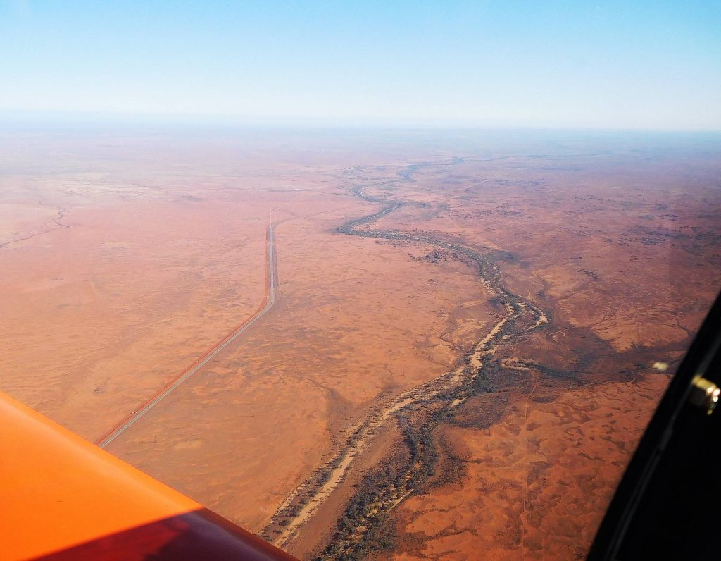 I was the first to YBHI so did a cross wind join for runway 32, the “little” unsealed cross strip, but at Broken Hill even the little cross strip is HUGE. We refueled and wandered along to the Aero Club where we had a very friendly greeting from a few of the local members and even came across a Sonex builder. By the time we walked back to our parked aircraft there was a little queue of yellow Bristells also forming at the fuel pump.
Fuel used: 25.45 litres at $2.36/litre
Tacho time: 1.36 hours
Av Speed: 93.38 knots
Broken Hill to Leigh Creek – 178 NM
Broken Hill to Marree is only 225 NM, so we could have flown directly, but the headwind was still pretty strong and I was a bit concerned about range, although it didn’t trouble Brian and Stuart who both have auxiliary fuel tanks. I had another reason for not wanting to go directly; we would be flying over the very rugged Flinders Range and by heading for Leigh Creek we would be passing over what appeared to be a slightly more benign part of the range. Last time I came this way I went for a tourist flight with Doug Sprigg from Arkaroola who blithely flew around at quite low altitudes in his Cessna as he pointed out landmarks, but I can recall thinking “If that engine goes phutt, we’re dead”. Again we gave Stuart a head start before Brian and I followed in a loose formation, but this time we managed to spot Stuart, well, Brian did, and then we messed around for a while trying to make a loose formation off Stuart’s left wing so he could get some pictures on his GoPro camera which, …. wasn’t working. Last time I flew this stretch it was just me and my autopilot (son-in-law Ricky) so having the company of other aircraft sure took my mind off the fact that if anything went wrong I was going to be doing an out-landing an awful long way from civilization. We soon reached the Flinders Range and I decided that they would look a lot better from 8500 feet. One of the great things about having a Jab 3300 up front is that 2000 foot climbs are a breeze, so it was up and over.
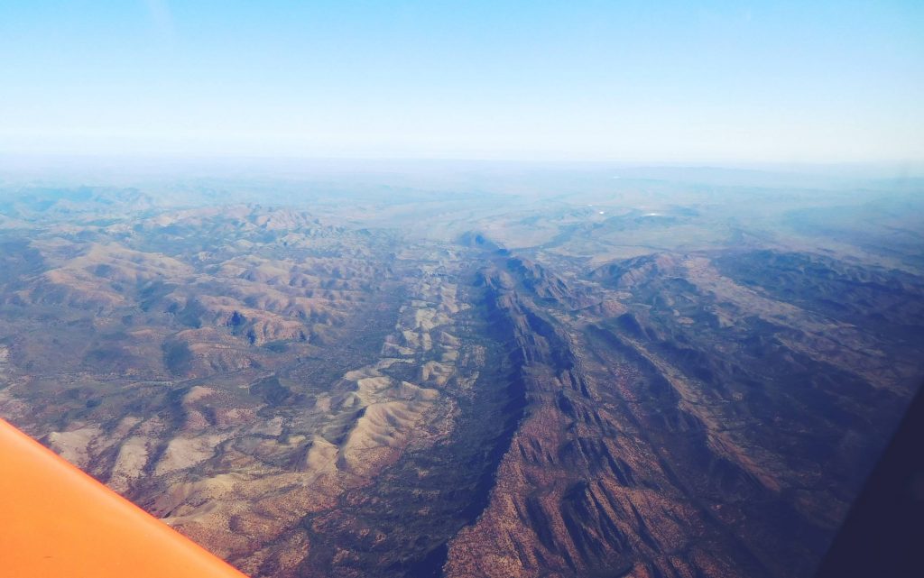
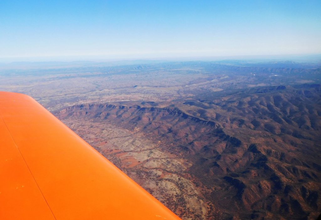
About 15 NM out we started our descent and from 10 NM it was easy to pick the airfield. We were looking straight down runway 29, a huge 1700 metre sealed strip with a 1200 metre sealed cross strip. That’s a lot of airfield for such a tiny town, but part of the secret is access for the flying doctor. The other part is the huge open cut coal mine that the town was built to service. In fact, on Google Earth, Leigh Creek looks like a housing estate that has been lifted up and plonked into the desert, 220 km from the nearest big town, Port Augusta. At its maximum, the town had a population of about 2500, but with gradual downsizing and finally closure of the mine the population is now fewer than 250. But at least they have a good airfield. It seems a bit hard to mock a town when it’s down so here goes:
A Leigh Creek mine worker named Roy Bent
Saw a Lady each week for enjoyment
But since he got the sack
He hasn’t been back
And she’s had to seek other employment
OK, it’s a bit contrived I know, but I hope it at least makes you aware of the plight of workers in the service industries when a large number of jobs in a town vanish.
Fuel used: 38.11 litres at $2.50/litre
Tacho time: 1.92 hours
Av Speed: 92.71 knots
Leigh Creek to Marree – 59 NM
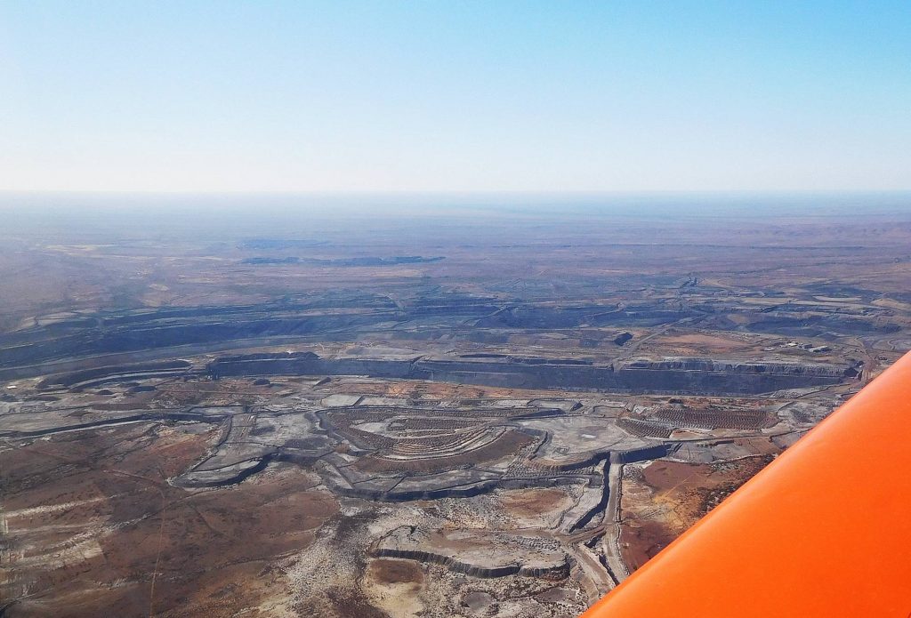
Leigh Creek was the last place where my phone would be anything but a pretty alarm clock so I phoned our progress to Sue. Marree and William creek are only covered by Optus so the extra cost I pay to Telstra for their wider mobile coverage would be useless. It was downhill in more ways than one because Leigh Creek is still in the lower regions of the Flinders Range at an altitude of 856 feet, but from there it’s downhill to Marree at 164 feet and Lake Eyre which is below sea level.
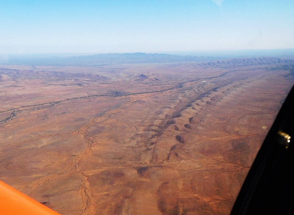
From the air, the country looked ever more desolate, but also rather beautiful, just not in the usual way we think of countryside being beautiful. Check it out on Google Earth some time. 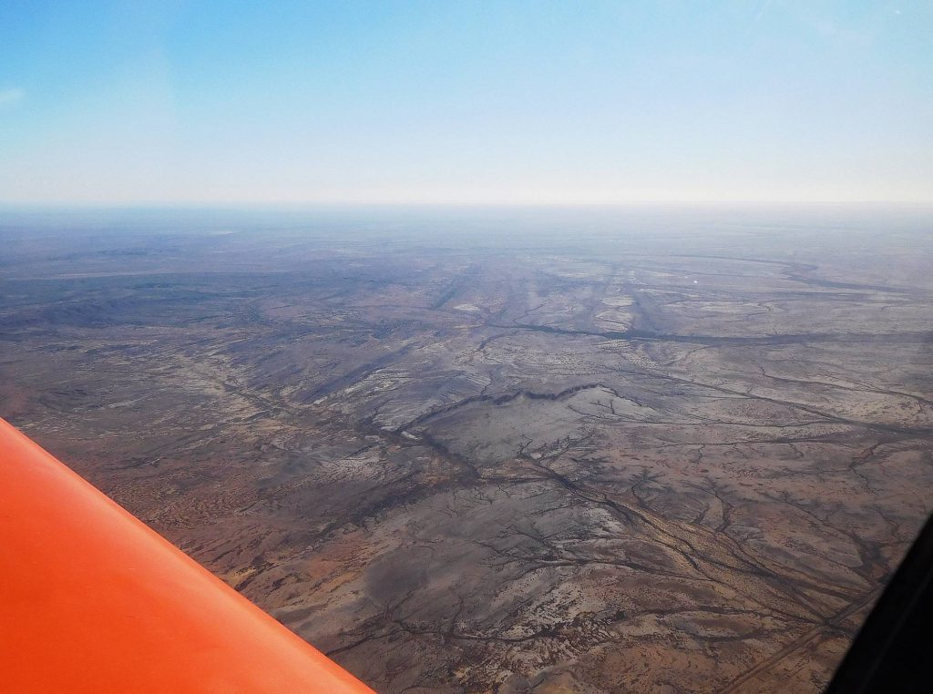 Stuart had phoned ahead for the prior permission to land and also flew over the pub so that before we had even tied down, a lift was waiting for us. We checked into our room at the Marree Hotel, “probably the best pub in Marree”, and adjourned to the bar to sample the wares.
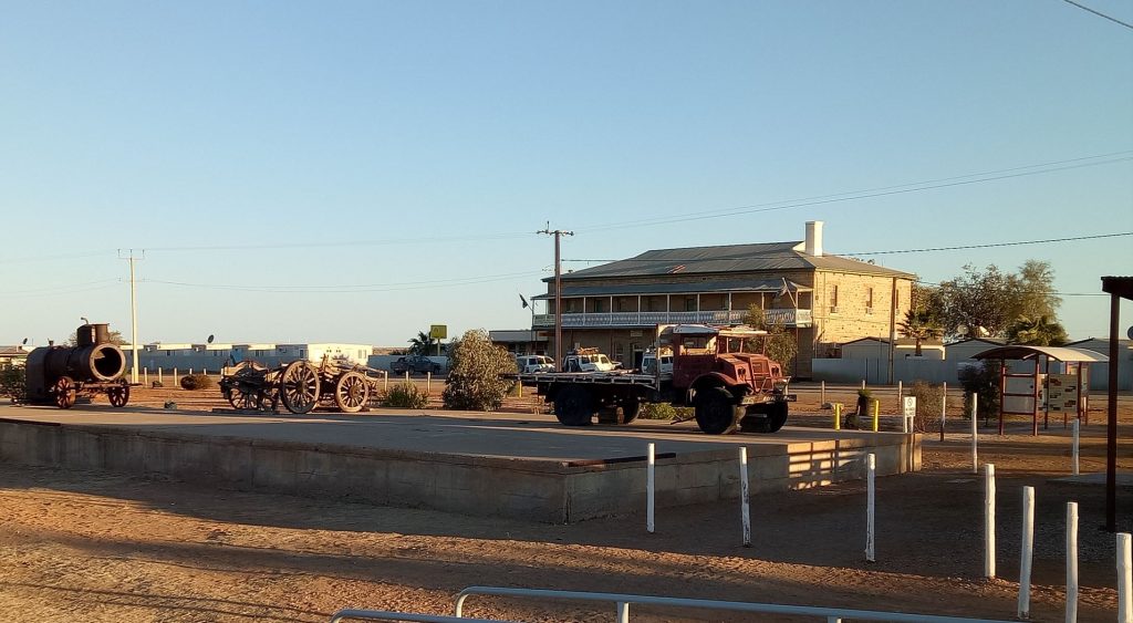
The pub was built in the 1880s, ancient in modern Australian terms and is heritage listed. It had been somewhat patched up with materials that were available, mainly old railway lines, but also modernized to some extent. Modernization didn’t extend to the floor in our upstairs room which produced the most incredible array of creaks and groans. We certainly weren’t going to get throttled in our beds by silent assassins.
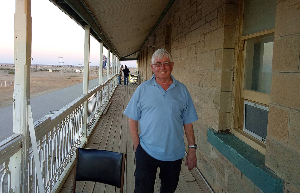
There was also a premium on power points for charging ipads and our now useless mobile phones. The staff members were a mini United Nations with a couple of grey nomads but others from Canada, Scotland, America and Europe. It seemed reasonably busy, as you might expect when the next pub is 110 km one way and 200 km the other. The history of Marree is quite interesting but rather than repeat bits of it, here’s a link so you can read it yourself if you are interested: Marree History
However, I will relate a bit of history because it is so typical of the mess we make of things in Australia. Marree was at one time the rail head, the end of the line, but in 1929 the line was extended all the way to Alice Springs, pretty much the centre of Australia. This was the Ghan, the old narrow gauge (3 ft 6 inch) line that was notoriously slow because the line was laid in low-lying flood prone areas and the track was often undermined or simply washed away. The simple reason for running the track through such unsuitable areas was the need for access to water for the steam engines. In 1957, a new standard gauge (4 ft 8.5inch) track was built as far as Marree, so it became a “break-of-gauge” station, where passengers and freight were transferred from one train to another. Now you might think that this was a pretty unusual situation but in 1939 there were more than a dozen break-of-gauge stations in Australia. This occurred because we started out as a bunch of separate colonies (“You all come from a convict colony”, as the Poms sing to the tune of “Yellow Submarine”) which for various reasons went their own ways on railway gauges. A standard gauge line between Melbourne and Sydney wasn’t completed until 1962 and I well remember doing the overnight train trip to Sydney in the late 1950s. At some time around midnight all the passengers would disembark at Albury and walk about one train length along the platform, in my case guided by my mother because I was half asleep, and board another train for the remainder of the trip to Sydney.
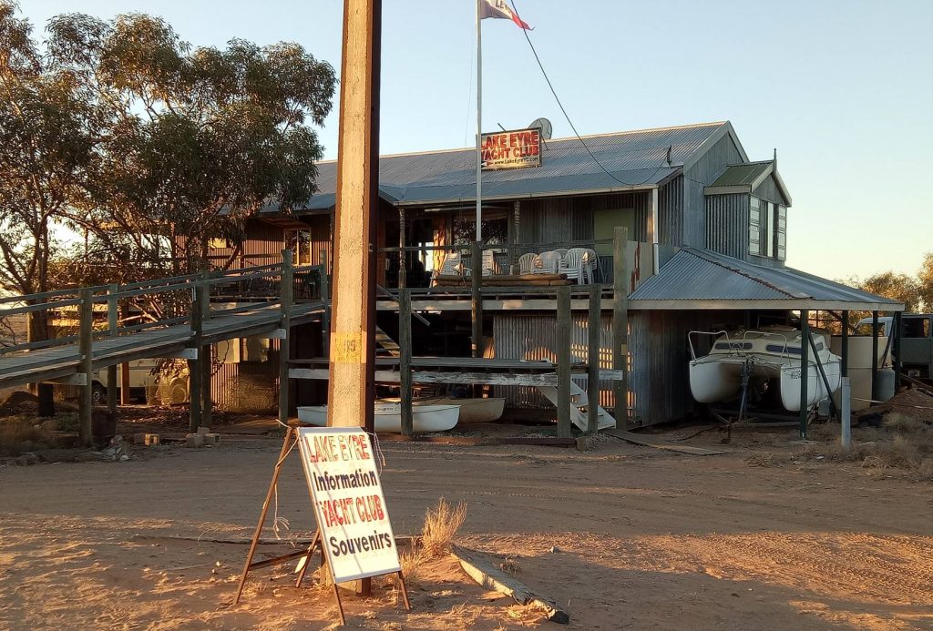
Marree to William Creek – 101 NM
This was the first part of our Lake Eyre tour. The intention was to refuel at William Creek and then return to Marree via the northern end of the lake. We had the use of the communal ute (utility vehicle or pickup truck) to drive to the airfield where we made sure we were all on the same plan and did our pre-flight checks. Again Stuart headed off first but Brian and I were in hot pursuit to again attempt a formation photograph, and again the Go Pro failed and us humans had to step in.
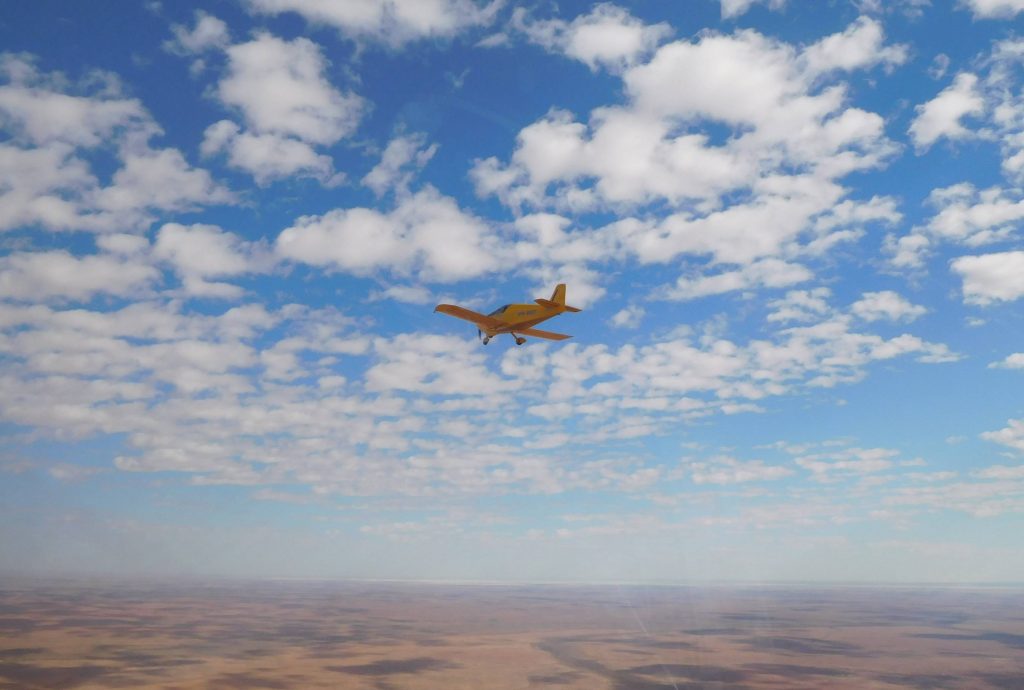
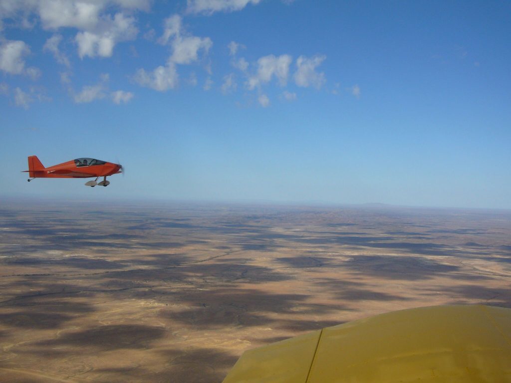
Soon we arrived at Marree Man, a 2.6 km long figure in the desert. It is quite obviously not traditional and rumoured to be the work of the Marree publican. Nevertheless, he is quite impressive from the air, and big in more ways than one.
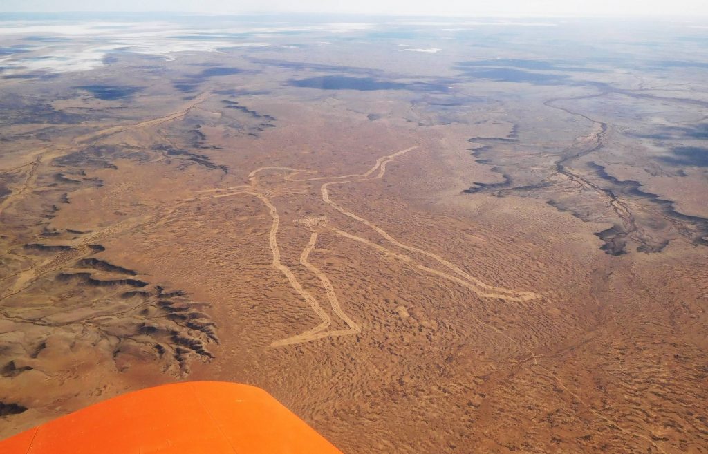
At this time we were also passing Lake Eyre South, which really deserves its own name; after all it is over 60 km long.
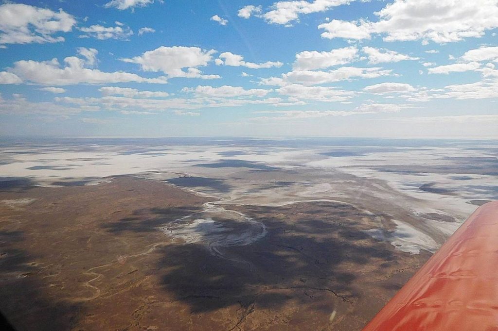
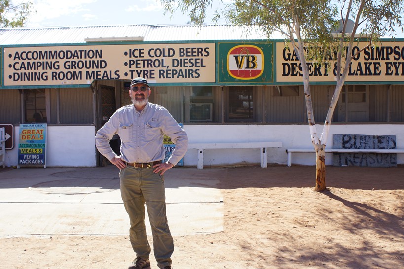
A bit more desert and we were on approach to William Creek. Other than the airfield the town consists of little but the pub and a bit of portable accommodation yet it was surprisingly busy. One aircraft departed just before our arrival and there were several parked. It appears that at this relatively cool part of the year we were not the only ones to think of taking a flight over the lake. We refueled, parked the Sonexes and then wandered down to the relocatable office to pay, and then to the quite busy pub where for us it was lemon lime and bitters time.
Fuel used: 33 litres at $3.00/litre – this was for the whole trip from Leigh Creek with the landing at Marree
Tacho time: 1.72 hours
Av Speed: 93.6 knots
William Creek to Marree – tour of the lake – 216 NM
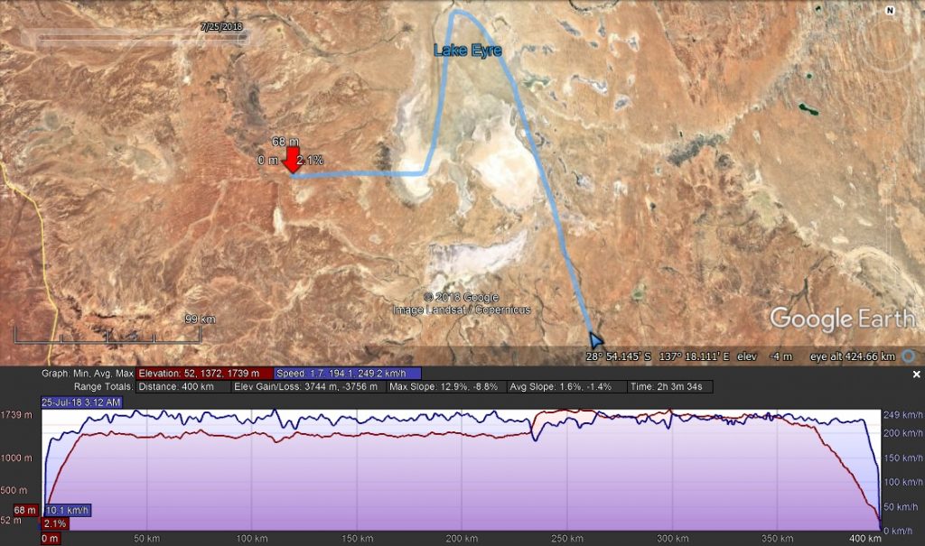
Here’s my track for this part of the trip. I know I often go on about flying in remote areas but it certainly occurred to me on this section that if anything went wrong it was going to be extremely difficult to recover the aircraft and the surface of the dry lake is not necessarily hard enough to support a vehicle. When we arrived back at Marree, one of the passengers on a departing joy flight was one of the local coppers on the look-out for a car which may have been driven out onto the lake bed and become bogged; a fairly common occurrence. Several aircraft have been lost this way too.
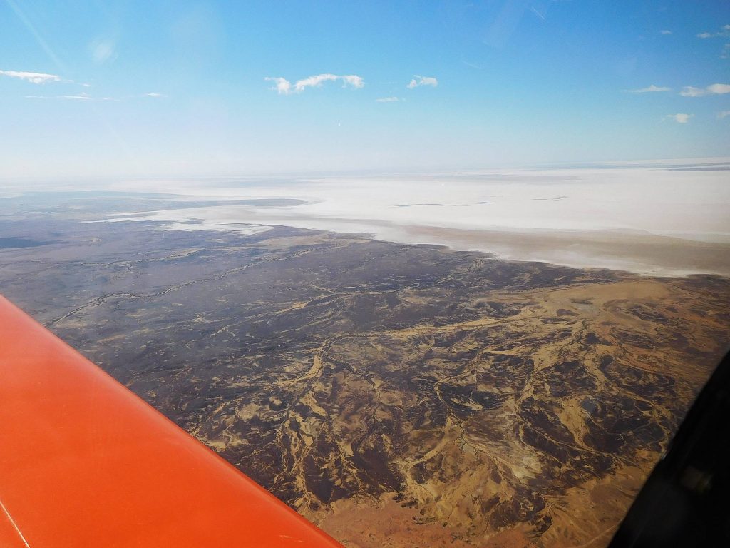
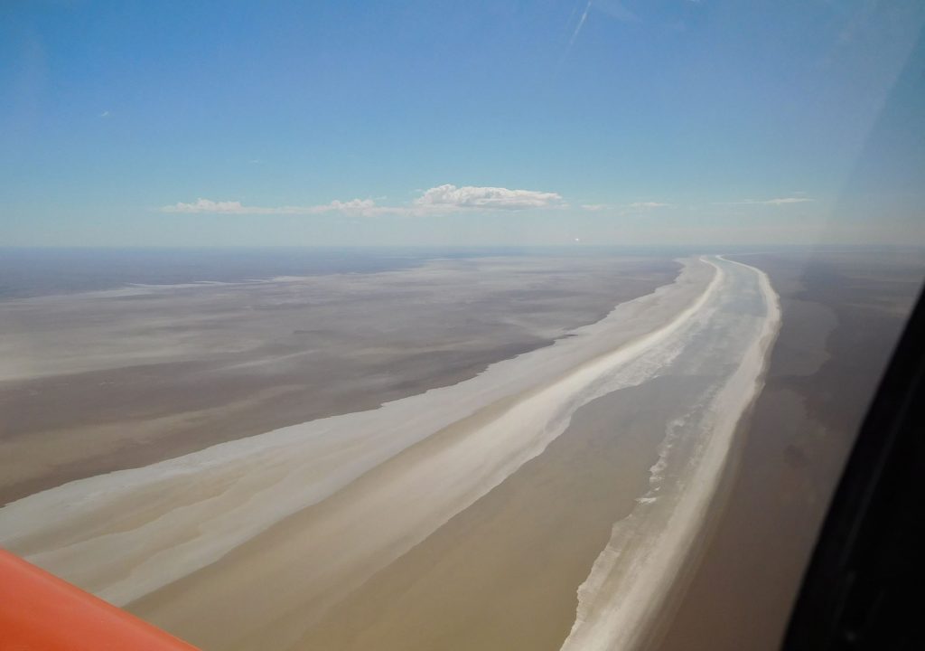
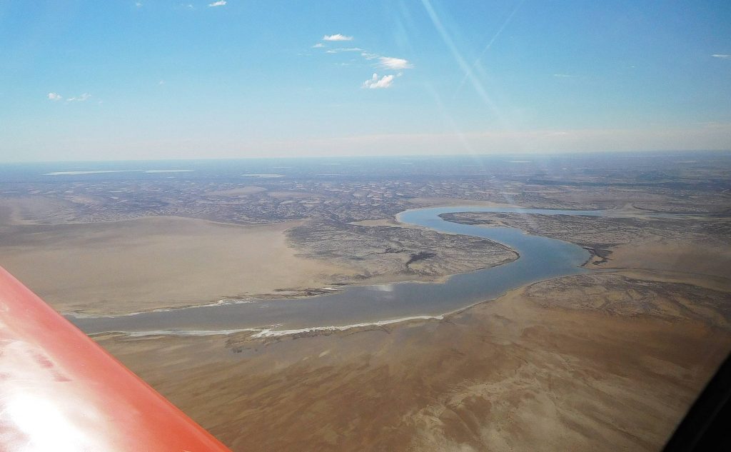
Isaac, the young pilot who gives tourist flights from Marree, was refueling his Cessna when we arrived so took the time to refuel 3 thirsty Sonexes and happily gave us the keys to the ute so we could drive into town and pay our bills at the service station/general store, where we also stocked up on flying food for the next day. By this time it was beer o’clock so we adjourned to the bar and then to the restaurant for another good meal. Over dinner and a bottle of red, Brian entertained us with a delightful part of his family history, but that’s Brian’s story so if you want to hear more, you’ll have to ask him. Got to say, this flying lark is pretty tiring and I don’t think any of us lasted past 9PM.
Fuel used: 35.3 litres at $3.00/litre
Tacho time: 1.81 hours
Av Speed: 119.34 knots
Marree to Broken Hill – 225 NM
No head wind this time so no worries doing the distance, and I guess I was becoming blasé about flying over rugged country. The sky was clear so I could go to 9500′ for a bit of extra safety margin when re-crossing the Flinders Range. We had breakfast, packed and were ready to go by about 8:30 and one of the staff took a break from pool cleaning to give us a lift to the airfield. A big thanks to all the people at the Marree Hotel; they really were wonderfully helpful. While we were warming up a Pilatus PC 12 came whistling in, the flying doctor apparently on a routine visit and not an emergency. I was the first with a warm engine so headed off from runway 04. The breeze at ground level was very light but the hoped for tail wind at 5500 ft gave me a ground speed of 140 knots so I had some good news for Brian and Stuart as they followed.
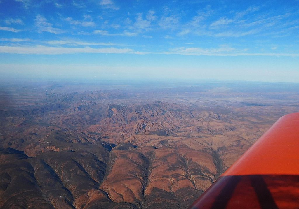
After crossing the range I went back down to 5500 but the speed was pretty much the same at all altitudes. The Jabiru engine buzzed happily up front and Broken Hill came into view. On the way in I passed the little village of Silverton, home to about 50 people but the scene for something like 140 movies, TV shows and advertisements. Apparently the attraction is that it looks like the end of the earth but is conveniently situated near a large town. At Broken Hill I circled over the top and did a crosswind join for runway 33, but that wide runway really caught me out. I think I must have still been a metre off the ground when she stopped flying and feeding in a little power to soften the blow was too little too late. Oh well, one more rough landing to add to the tally. I had just finished refueling when Brian appeared and a short time later a small yellow aircraft arrived, but not Stuart, the first of the Bristells on their way home from Coober Pedy.
Fuel used: 36.9 litres at $2.36/litre
Tacho time: 1.89 hours
Av Speed: 119.05 knots
Broken Hill to Swan Hill via Menindee and Pooncarie – 245 NM
Stuart had arrived and joined the queue at the fuel pump but I was ready to go so did the long taxi to 33 and an over the top departure on a heading of 106 for Menindee, only 50 NM away. There are about 10 or so lakes along the Darling River, the largest being Lake Menindee itself at 16 km by 13 km, but it was completely empty, although the smaller lakes appeared to still be holding water. At 7500 feet I was not in the best place to judge that. Further south west is Lake Tandou which doesn’t even pretend to be a lake anymore. It appears to be a large market garden that is irrigated by the Darling.
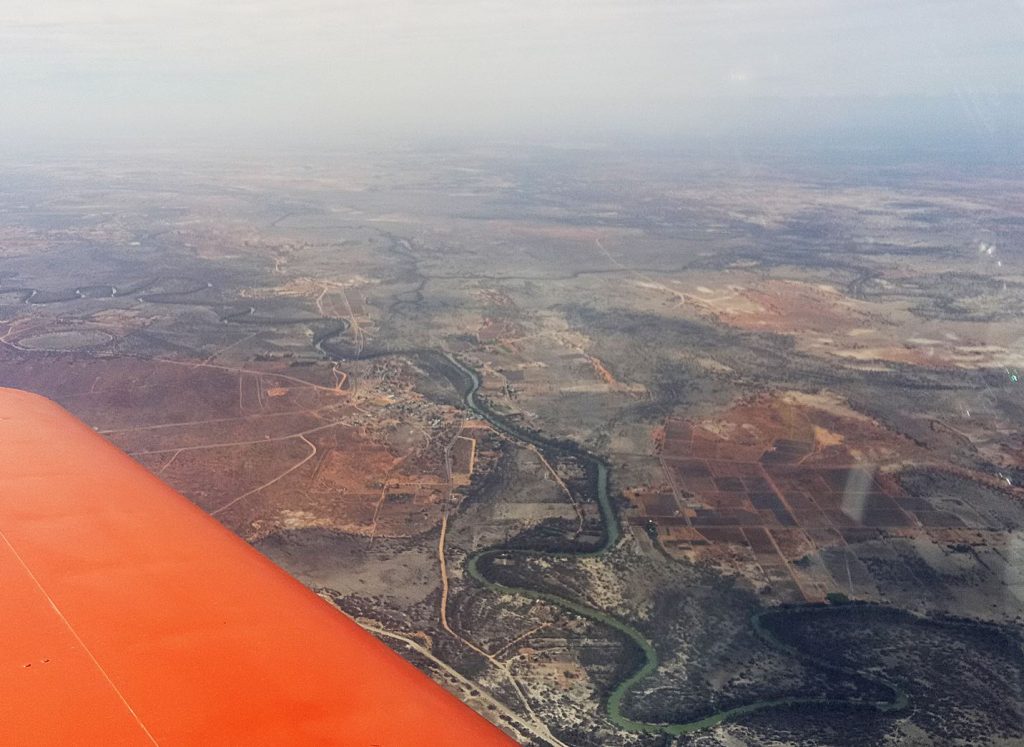
From Menindee I roughly followed the course of the Darling to the village of Pooncarie and then turned for Lake Mungo. Mungo is no longer a lake except in name but many thousands of years ago the lake was the centre of a thriving aboriginal community. The eastern side of the lake has formed into sand dunes, the “Walls of China”, and it is there that archeologists have discovered the remains of people dating back to over 30,000 years ago, the first proof that the aboriginal people have been here a bloody long time. Another interesting aspect was that the bodies had been ceremonially buried – there were traces of ochre which isn’t found in this area. There was a trade in ochre which was often carried more than 1000 kilometers; a good long walk. At Mungo I climbed to 9500 feet to clear scattered clouds and was soon over the oasis of the Murray river and a long descent to Swan Hill.
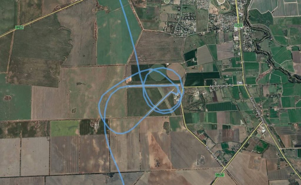
Here’s a picture of my confusion as I worked out in-to-wind runway. I eventually settled for 04, but wind at ground level was pretty light and I saved myself the long taxi by taking off from 26.
Fuel used: 37.38 litres at $2.28/litre
Tacho time: 1.95 hours
Av Speed: 126.64 knots
Swan Hill to Kyneton – 119 NM
It’s amazing how short this distance seems at the end of a 1500 nautical mile trip. I climbed to 7500 to clear the still scattered cloud layer and again picked up 140 knots ground speed but it wasn’t to be; the clouds closed in and after only 40 NM had to do a spiraling descent to 3500 and soon had to go even lower.
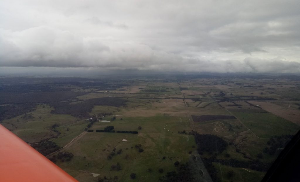
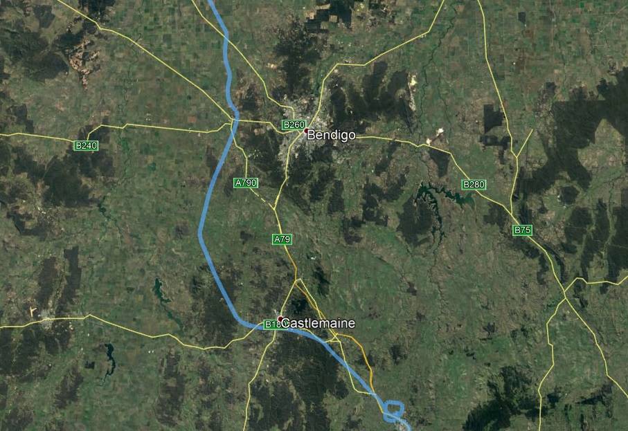
Mount Macedon, to the south east of Kyneton was lost in the gloom and my only sure option was Bendigo but I have seen this scenario a couple of times before so headed south in the hope of finding a gap through the squalls. I know this part of the land pretty well and the towns and various landmarks are easy to pick. There was a gap over Castlemaine and I was even able to climb a little to 2900 ft. I prefer a bit higher over this little patch of countryside as it’s pretty rugged, but home was in sight. Here’s my meandering path to Kyneton:
Fuel used: 22.61 litres at $2.56/litre
Tacho time: 1.11 hours
Av Speed: 100.6 knots
Hmmm, wonder how the others went. I phoned Brian later and they had both made it safely back to Mangalore although Stuart had been hoping to make it to Moorabbin, so not everything went to plan, but what did go to plan was an enjoyable trip with good company. I really liked the friendly atmosphere in the little communities we visited and unusually for us city slickers we could wander across roads without a thought. If there had been any traffic we would have heard it coming a mile off.
Summary for the whole trip
Total distance 1502 nautical miles -1729 miles – 2782 km
Total flying time: 14.93 hours
Fuel used: 288.8 litres – 76.3 US gallons
19.34 litres/hour – 5.11 US gallons/hour
Average speed: 100.6 knots – 116 mph – 186 km/h