(click on images for larger view)
I have done quite a few trips to Mount Gambier because I have a friend and fellow Sonex builder who lives there, John Lerwill. Mount Gambier is in the south east corner of the state of South Australia and is the second largest city in that state after Adelaide; quite a long way after Adelaide. I also have past association with Mount Gambier. It has a very active motorcycle club that has its own race track, MacNamara Park, known to all the bike fraternity simply as Mac Park. Many years ago I would travel there around 3 times a year to race motorbikes. It’s about a 5 hour drive and with a trailer in tow and the increased fuel consumption it was always a bit touch and go making the distance. The trips were always at night and the whole of western Victoria seemed to be closed for business. On one occasion I did the last 20 or 30 km on 2-stroke pre-mix. Arriving at Mount Gambier always felt like reaching an oasis in the desert. The Sonex shrinks the 5 hour drive down to a 90 minute flight over mostly open farmland.
The forecast was for hot weather, mid 30s (translation: lots of thermals – you better not be flying a Sonex after 10 AM) so I set the alarm for 5:30 and was eventually ready for a 7:30 take-off from runway 18 into a light southerly which wouldn’t slow the progress too much. The first leg on a heading of 217º to the village of Korweinguboora is only 10 minutes. I try to do this section at 4500′ because it’s not over open farming land. A forced landing would be exciting. 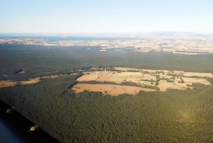 Korweinguboora is pretty easy to pick because a cooperative from Daylesford has a couple of wind turbines just to the north at Leonard’s Hill.
The next leg on heading 253º is 100 nm and takes me just to the north of Ballarat, the fourth largest city in Victoria. The history of Ballarat is all about gold, and most of the beautiful old buildings in the city owe their existence to that decorative metal. It was also the site of the 1854 Eureka Stockade, the only rebellion, by whites anyway, against British rule in Australia, although it wasn’t so much a rebellion against British rule as against the tax the miners were forced to pay in the form of a miner’s licence. The Eureka rebellion is sometimes credited with an 1857 bill granting universal suffrage for white males in Victoria, but since other Australian colonies granted voting rights at about that time, maybe that is giving too much credit to the half-hour battle. 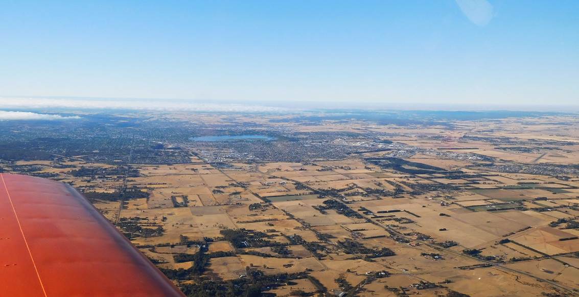 At the centre of the photograph is Lake Wendouree and at the far right is the Ballarat airfield, one of many WW2 training airfields around Australia. In my youth I spent a bit of time at the airfield training to be a pretend soldier in the CMF, now the Army Reserve, while simultaneously avoiding an all-expenses-paid holiday in Vietnam. I would have been a terrible soldier, but I quite liked driving the trucks which at that time were WW2 vintage Studebaker 6-wheel drives.
I besmirched the name of Horsham in my last trip report, so now it’s Ballarat’s turn:
A distiller in old Ballarat
Wore a bucket instead of a hat
He found it quite handy
When blending his brandy
And of course whenever he shat
(My apologies to lovers of good brandy, good poetry and good taste.)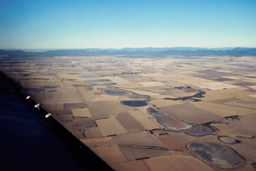 About 50 nm further to this string of lakes evaporating in the summer sun with the Grampians in the background.
 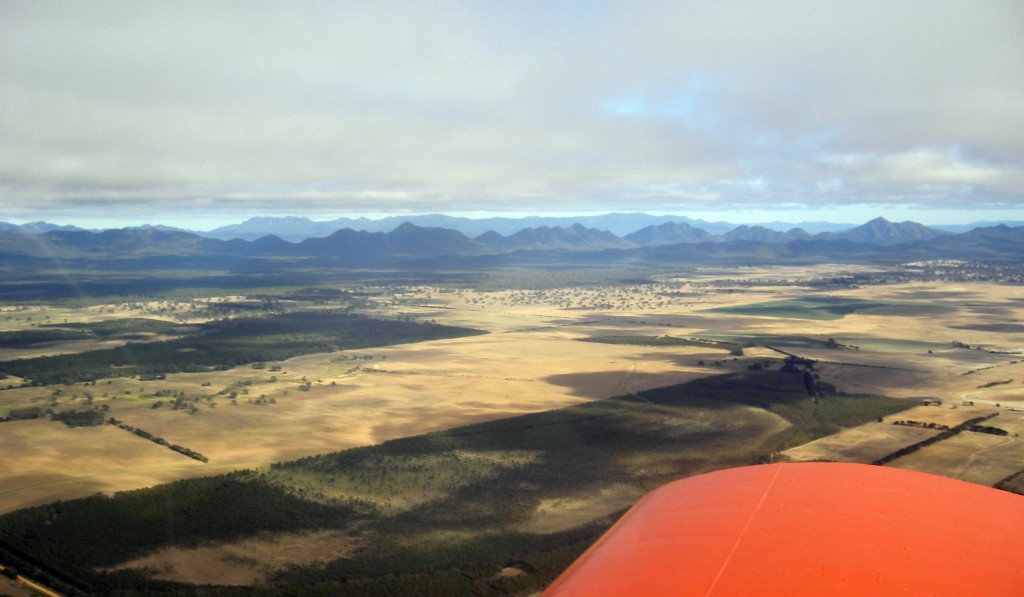 Getting closer to the Grampians. There wasn’t a sudden change in the weather. These pics are from an earlier trip.
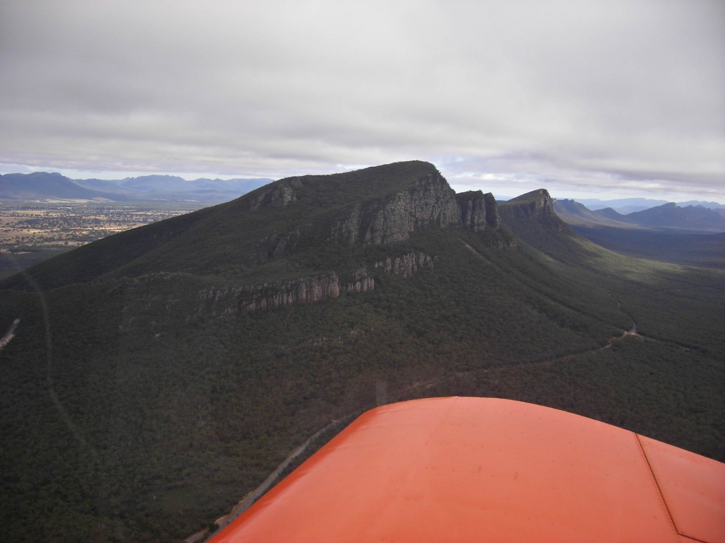
My inbound call to Hamilton, my next turning point, was followed immediately by a call from a Technam in the same location but 200 ft higher. We were both tracking for Mount Gambier, and while I couldn’t see him, I guessed that the Sonex would be able to outrun him to YMTG, which proved to be the case. I phoned John while passing Casterton, so that by the time I had refueled there was a lift waiting for me.
John and I spent most of the day completing the flush riveting of one main spar and countersinking, deburring and assembling the other spar ready for riveting. All the riveting was done using a 3-ton arbour press which was quite quick and produced a good finish on the flush head side. We finished up at about 5:30 and adjourned to a local Thai restaurant with John’s wife, Jackie, for a very good meal.
The next day was going to be another hot one so John dropped me at the airfield at about 7:15. The weather forecast was for light south westerlies which would be ideal, but when we arrived at the airfield, the wind sock was showing a light north easterly, exactly opposite to the forecast. I was intending to do a short local flight before heading home so departed from runway 06 and then turned south-west heading for Mac Park, my first photo spot, and climbed to about 1000′ AGL and was surprised to see well over 140 knots on my GPS. Looks like the wind at altitude was considerably above ground level wind and my home trip was going to be slow. Oh, well. 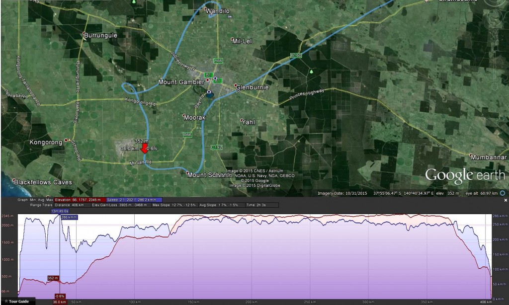 Here’s my sight-seeing track around Mount Gambier together with the speed and altitude plot for the whole trip. The red arrow shows the maximum speed point, 286km/h (154 knots, 178 mph) where I was just doodling around looking for a local landmark, the Little Blue Lake.
 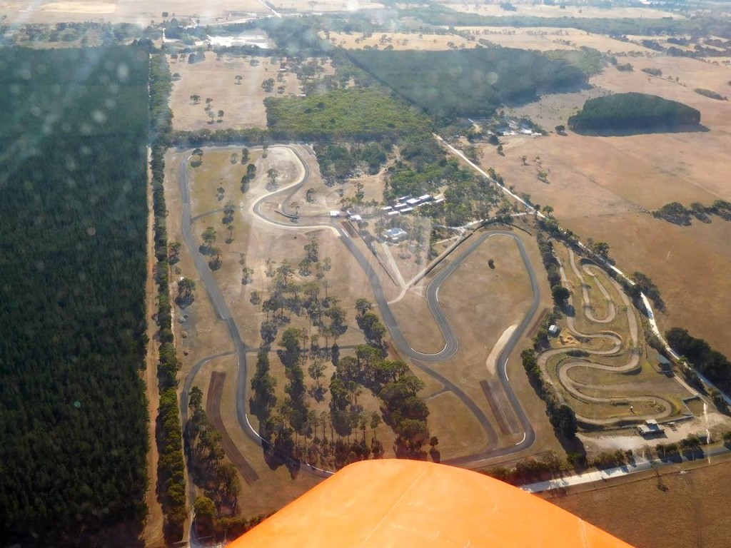 Here’s Mac Park. I first raced here in 1968. At that time it was only 3/4 mile around but it grew a couple of times after that. It’s quite tight which suits smaller bikes, and also narrow; bikes and go-karts only. What isn’t obvious from the photo is that the track is fairly undulating. It used to have a surface of gravel pressed into tar rather than hot-mix which gave it good grip even in the wet, but made it pretty abrasive on tyres and crashing riders. On the other hand, I can only recall crashing there once and that was the result of doing stupid things trying to compensate for a slipping clutch.
 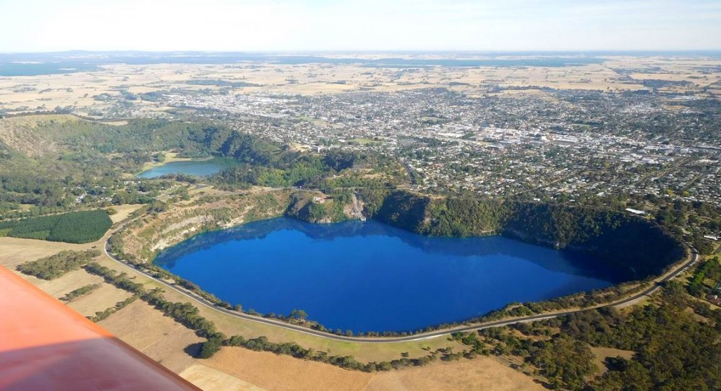 Here is the beautiful Blue Lake. There were originally 5 lakes in this group but the water table has dropped leaving only 3. The Blue Lake, which fills an extinct volcano is over 70 metres deep and its colour is always pretty vivid, but apparently more so in summer. Visit Wikipedia for a detailed explanation.
 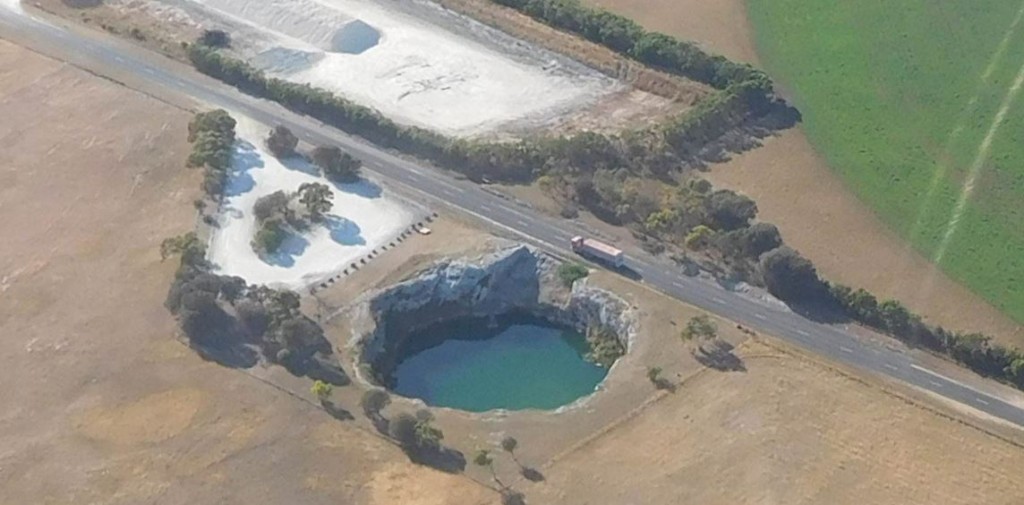 And here is the Little Blue Lake. I can recall seeing this around 40 years ago and it was as vivid as its bigger namesake but these days it looks more turquoise due to the presence of algae.
 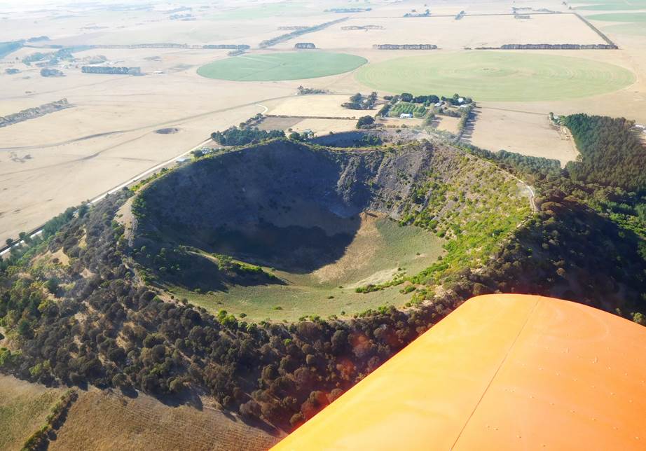 Nearby is Mount Schanck, another dormant volcano. Mount Gambier and Mount Schanck were active around 6000 years ago, so not all that long ago in geological terms. When I visited Mount Schanck around 40 years ago somebody had laid out a sign in white painted boulders at the bottom of the crater that said “Jesus Saves”, but perhaps he’s not doing that any more.
I took my photos of Mount Gambier and then picked up the course home, but as I climbed there was a pleasant surprise; the ground speed climbed too. At 7500 ft the Sonex maintained a fairly easy 140+ knots until I was approaching Ballarat when the speed eased off to around 135 knots. A short time after passing Ballarat I phoned my wife to let her know I was still alive, the little speed dip in the graph when I turned down the noise for a while, and it was soon time to start my descent for Kyneton where I landed on runway 36 into a light northerly wind. Total flight time including sight seeing and taxying was 2 hours.